SAR Nantabibbie: Difference between revisions
From TrainzOnline
Jump to navigationJump to search
mNo edit summary |
mNo edit summary |
||
| (One intermediate revision by the same user not shown) | |||
| Line 75: | Line 75: | ||
<tr valign="top"> | <tr valign="top"> | ||
<td width=750> | <td width=750> | ||
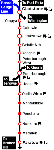
<span style="font-weight: 700;"><span style="color: white; background-color: black;"> Distance from Peterborough: </span> 34 kms, 21¼ miles</span><br> | |||
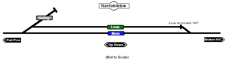
Unmanned location on the <span style="font-weight: 700; color: white; background-color: black;"> Port Pirie-Broken Hill Line </span>.<br> | Unmanned location on the <span style="font-weight: 700; color: white; background-color: black;"> Port Pirie-Broken Hill Line </span>.<br> | ||
A short | A short crossing loop (not suitable for long trains) and a works siding. The loop had been converted to a dead end siding by 1967.<br> | ||
This location was bypassed when the line was converted to standard gauge during 1969-1970. | This location was bypassed when the line was converted to standard gauge (4ft8½in - 1435mm) during 1969-1970. | ||
</td> | </td> | ||
</tr> | </tr> | ||
Latest revision as of 00:17, 11 March 2023
|
 |