SAR Nantabibbie (Basic): Difference between revisions
From TrainzOnline
Jump to navigationJump to search
mNo edit summary |
mNo edit summary |
||
| Line 4: | Line 4: | ||
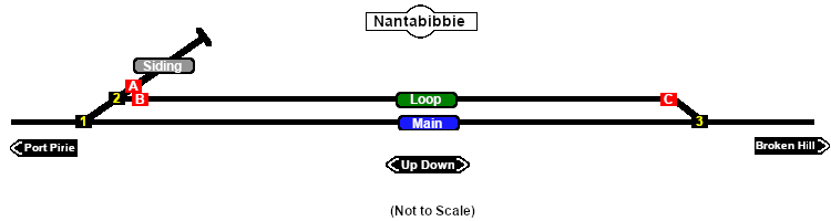
[[Image:SAR_Nantabibbie_Basic.png|link=|alt=Nantabibbie]]<br> | [[Image:SAR_Nantabibbie_Basic.png|link=|alt=Nantabibbie]]<br> | ||
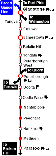
Main Line with a Passing Loop. Unmanned location on the '''Peterborough to Paratoo''' section of the '''Port Pirie to Broken Hill line'''. | Main Line with a Passing Loop. Unmanned location on the '''Peterborough to Paratoo''' section of the '''Port Pirie to Broken Hill line'''. This location was bypassed when the line was converted to standard gauge in 1969. | ||
<table bgcolor="lightgrey" bordercolor="lightgrey"> | <table bgcolor="lightgrey" bordercolor="lightgrey"> | ||
Revision as of 02:30, 17 November 2019
|
Main Line with a Passing Loop. Unmanned location on the Peterborough to Paratoo section of the Port Pirie to Broken Hill line. This location was bypassed when the line was converted to standard gauge in 1969.
|
 |
|||||||||||||||||||||||||||||||||||||||||||||||||||||||||||