SAR Gumbowie (Basic): Difference between revisions
From TrainzOnline
Jump to navigationJump to search
mNo edit summary |
mNo edit summary |
||
| Line 3: | Line 3: | ||
<td width=750> | <td width=750> | ||
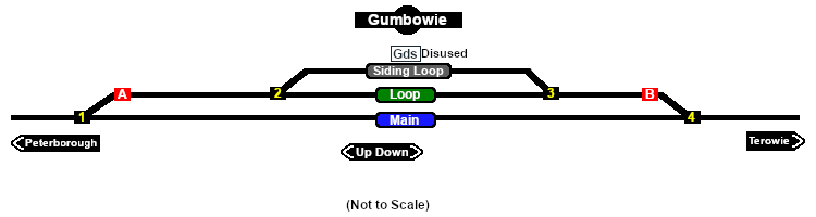
[[Image:SAR_Gumbowie_Basic.png|link=|alt=Gumbowie]]<br> | [[Image:SAR_Gumbowie_Basic.png|link=|alt=Gumbowie]]<br> | ||
<table> | |||
Main Line with a Passing Loop and a siding. Unmanned location on the '''Peterborough to Terowie line'''. | <tr valign="top"> | ||
<td width=600> | |||
Main Line with a Passing Loop and a siding with a disused goods loading platform. Unmanned location on the '''Peterborough to Terowie line'''. | |||
</td> | |||
<td width=150> | |||
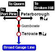
[[image:SwitchToPaths.png|link=SAR Gumbowie|alt=To Paths|Show Path Diagram]] | |||
</td> | |||
</tr> | |||
</table> | |||
<table bgcolor="lightgrey" bordercolor="lightgrey"> | <table bgcolor="lightgrey" bordercolor="lightgrey"> | ||
Revision as of 11:34, 8 April 2020
|
|
 |
|||||||||||||||||||||||||||||||||||||||||||||||||||||||||||||