SAR Gumbowie: Difference between revisions
From TrainzOnline
Jump to navigationJump to search
mNo edit summary |
mNo edit summary |
||
| Line 79: | Line 79: | ||
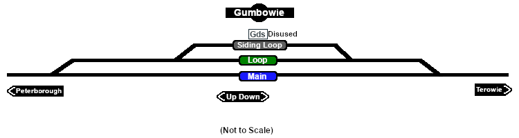
Passing and siding loops. A signal box and a small station building that were originally present on the main line had been removed by the start of the 1960s. After '''Belalie North''' was bypassed by the gauge conversion (1969-70) '''Gumbowie''' became the highest point in the '''SAR''' system.<br> | Passing and siding loops. A signal box and a small station building that were originally present on the main line had been removed by the start of the 1960s. After '''Belalie North''' was bypassed by the gauge conversion (1969-70) '''Gumbowie''' became the highest point in the '''SAR''' system.<br> | ||
The loop | The main line and passing loop were converted to dual gauge (narrow 3ft 6in, 1067mm and broad 5ft 3in, 1600mm) in 1970 but the siding remained narrow gauge only. The line was closed in 1988. | ||
</td> | </td> | ||
</tr> | </tr> | ||
Revision as of 06:58, 11 February 2022
|
 |