SAR Belalie North: Difference between revisions

From TrainzOnline
Jump to navigationJump to search
Pware (talk | contribs)
mNo edit summary
Pware (talk | contribs)
mNo edit summary
Line 1: Line 1:
<!-- This is V1.0. A V2.0 version is available -->
<table> <!-- BEGIN TOP TABLE -->
<tr valign="top">
<tr valign="top">

Revision as of 04:40, 28 June 2022

    
PortPirie-BrokenHill
Jamestown
Location Index
Scenarios

Yongala
PortPirie-BrokenHill

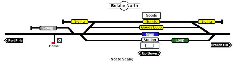
Belalie North map

 Commodities: 
Passengers
Passengers
Goods
Goods
     
 
 Facilities: 
Loop
Loop
     

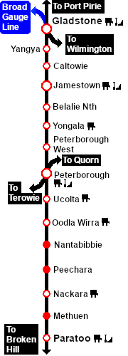
Unmanned station on the  Port Pirie-Broken Hill Line .

Station, goods and passing loops with sidings. At 621m (2,037ft) Belalie North was the highest point in all of the SAR.

This location was bypassed in favour of an alignment with easier grades when the line was converted to standard gauge during 1969-1970.

PortPirie-BrokenHill

Gladstone-Paratoo Strip Map