Users of Trainz Railroad Simulator 2019 (known as TS19) will find a tutorial specific to that product at TS19 Environment and Lighting Tutorial
 |
Notes:
There is no Save button on the Environment Tools Window. As soon as you enter or select a setting it will be saved. When finished editing simply click the window Off button. |
 |
The World Origin and Date settings are used to set the current season e.g. January = Summer in the Southern Hemisphere and Winter in the Northern Hemisphere |
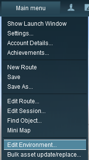 |
Open the Environment Tools Editor from the Surveyor Main Menu as shown on the left.
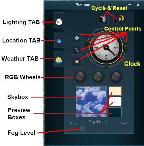
This will open the Environment Properties Window as shown below.
|
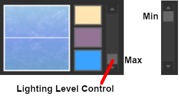
TS19 has an additional control that adjusts the lighting level, as shown below
|
|
Lighting
The Lighting Tools control the ambient, sun and water colours. This tool tab is opened by default whenever the Environmental Editor is opened.
Light and Time
|
The dial shown is a 24 hour clock that sets the lighting conditions at selected times of the day and night |
Setting the Lighting Conditions
Colour Control Points
The ring around the dial contains a number of green dots.
|
Each dot is a Control Point that sets the specific Red, Green and Blue colour values, and other lighting features, at the time shown on the clock |
|
Each colour value can be altered by dragging its needle point to a new position around the dial. Each new position will change the balance between the 3 colours and will alter the lighting displayed in the scene at that particular time. |
Types of Lighting
|
Notes:
Each control point stores the RGB values for three different types of lighting in the scene.
- The Ambient Colour which is the directional lighting and mostly affects the hue of buildings and other scenery objects
- The Sun Colour which affects the colour of the sunlight and mostly affects the hue of the terrain
- The Water Colour which affects the colours reflected by water surfaces
|
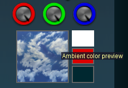
The 3 boxes below the colour wheels and next to the Sky box show the colour effects created for each type of lighting at the selected time.
Ambient Colour
 |
|
 |
Steps:
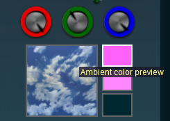
- Click on the top box of the three. This is the Ambient Colour
- The dials will show the RGB values for the Ambient Colour at the selected time
- The Ambient color preview box will show the colour produced by the RGB settings
- You can then change the RGB settings for the Ambient Colour
|
|
|
Sun Colour
 |
|
|
Steps:
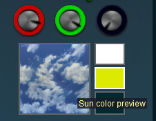
- Click on the middle box of the three. This is the Sun Colour
- The dials will show the RGB values for the Sun Colour at the selected time
- The Sun color preview box will show the colour produced by the RGB settings
- You can then change the RGB settings for the Sun Colour
|
|
|
Water Colour
 |
 |
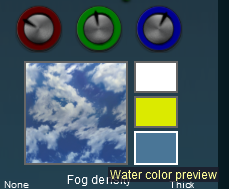
Water Colour values set for one control point become the values for ALL the control points |
|
|
Steps:
- Click on the bottom box of the three. This is the Water Colour
- The dials will show the RGB values for the Water Colour
- The Water color preview box will show the colour produced by the RGB settings
- You can then change the RGB settings for the Water Colour
|
|
|
Mixing Colours
|
Notes:
Getting the "right colours" can be more of an art than a science. To set the exact colour you want means mixing the correct quantities of Red, Green and Blue. Each of these colours has 256 different values from 0 to 255 that, when combined, produce over 16 million different possible colours - but many monitors and most eyeballs will not be able to tell the differences between many of those 16 million colours. |
 |
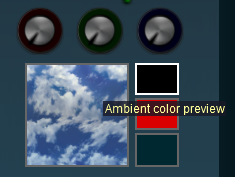
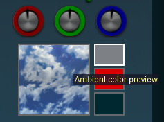
Setting all three colours to the same values will produce monotones from Black to White with 254 different shades of gray between those two tones. Note that in the examples below, the "tyre" around each wheel shows the exact quantity of colour that is being added. |
| R = 0; G = 0; B = 0 |
R = 128; G = 128; B = 128 |
R = 255; G = 255; B = 255 |
 |
 |
 |
| Black |
50% Gray |
White |
|
All other colours are made by mixing different quantities of the three colours. |
Example:
Creating a colour suitable for water (RGB values are approximate) |
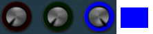 |
Starting with pure Blue
R = 0; G = 0; B = 255 |
 |
Add pure Green to make the colour Cyan
R = 0; G = 255; B = 255 |
 |
Scale back (darken) the Green
R = 0; G = 155; B = 255 |
 |
Scale back a bit more
R = 0; G = 128; B = 255 |
 |
Add some Red
R = 75; G = 128; B = 255 |
TS19 Lighting Level Control
TS19 users have an additional control that is placed next to the Ambient, Sun and Water colour boxes. This sets the overall brightness or lighting level for each control point.
Resetting the Lighting Conditions
|
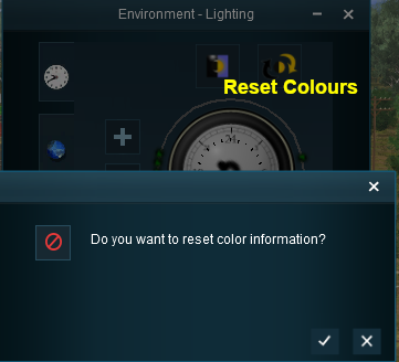
All the lighting colour settings can be reset back to the TANE default colours. |
 |
|
|
Steps:
- Click the Color Reset button, then either:-
- Click the
 icon to accept the reset, or
- Click the
 icon to reject the reset
|
|
|
Adding a New Control Point
|
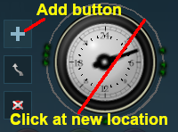
New control points can be added to the clock dial |
 |
|
|
Steps:
- Click the Add button

- Click on the ring at the place where the new control point is to be located
|
|
|
|
Notes:
During the running of a Session the lighting will "morph" or "transform" at a steady rate from the set of colour values at one control point to the set of colour values at the next control point. Click the Diurnal Cycle button for a demonstration.
- If the control points are far apart then the transition will be gradual
- If the control points are close together then the transition will be faster
- If there are several control points grouped closely together then the transitions can be more dramatic
The places where you would need faster dramatic transitions would be at dawn (around 06:00) and dusk (around 18:00)
|
Deleting a Control point
|
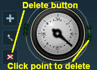
Existing control points can be deleted |
 |
|
|
Steps:
- Click the Delete button

- Click on the control point to be deleted
|
|
|
Moving a Control point
|
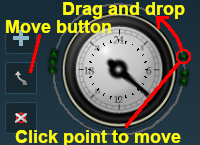
Existing control points can be moved |
 |
|
|
Steps:
- Click the Move button

- Click on the control point to be moved and hold the mouse button down
- Drag the point to its new position around the ring
|
|
|
The Skybox
|
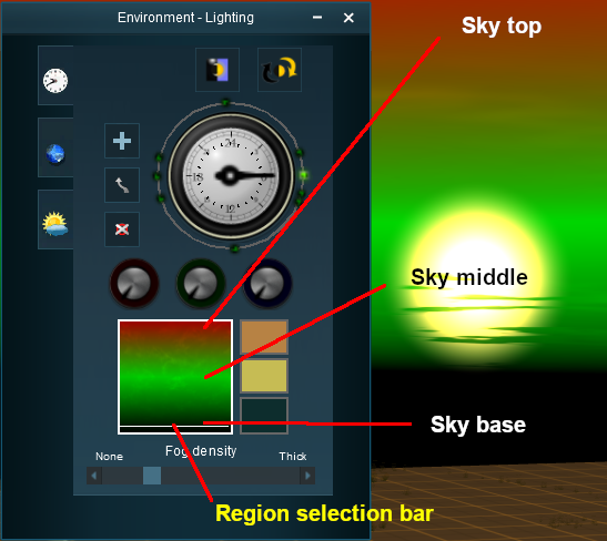
The Skybox sets the sky colours in three different regions of the sky at the selected time of day, as shown in the extreme example below |
 |
|
Notes:
Each control point also stores the Skybox settings for that particular time. |
|
|
Steps:
- Select a control point for a specific time of day
- Click in a region of the Skybox (top, middle, bottom) - a while line or bar will appear across the selected region
- Set the RGB color wheels for the selected region
- Repeat for the other two regions and for other times of the day/night as needed
|
|
In the areas between the three regions the colours will be blended to create a smooth transition. |
Fog Control
|
This controls the level of "fog" in the scene |
Location
|
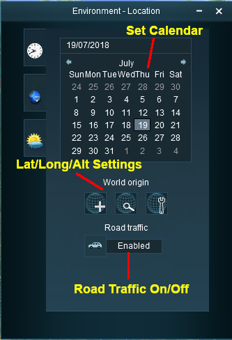
The Location Tools control the geographic and date (season) data for the Route and Session |
 |
Set Date
The top section is a standard calendar selection tool that allows you to set the month and the day of the month. The only effect this has in TANE is to set, with the geographic coordinates, the season of the year.
Set World Origin
The middle section is the World Origin Tool and sets the geographic location, including the altitude, of the route using a World Origin marker that is only visible in Surveyor.
|
Setting the World Origin does NOT set regional features such as which side of the road the cars drive on. Use the Route Editor - Region setting for that |
|
The World Origin is always part of a Route, not part of a Session |
Once it has been placed, the marker can be moved by dragging or clicking with the mouse. After adding the marker it should be edited to add geographic data. |
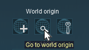 |
Click the Go to world origin icon to move the Surveyor screen so that it is centred on the World Origin marker. |
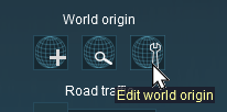 |
Click the Edit world origin icon to set or edit the World Origin data. See Editing the World Origin below. |
Editing the World Origin
Deleting the World Origin
|
There is no delete button for the World Origin marker, but you can still delete it |
|
|
Steps:
- Open the Objects Tool in the Surveyor screen
- Select the Delete tool
- Click on the World Origin marker
|
|
|
Notes:
All routes MUST have a World Origin. If you delete the marker then the World Origin will be hidden and will take the default coordinates of latitude 52.45 N, longitude 13.3 E, altitude 0 metres - which places it in Berlin(??). |
Traffic Control
|
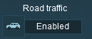
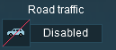
This tool simply turns the road traffic ON and OFF |
|
Notes:
This road traffic tool:-
- only works on roads that have been designed to use road traffic (not all roads support traffic)
- does not set the road traffic characteristics - number and types of vehicles, which side of the road is used. These features are set in the Route Editor - Region setting
|
 |
|
 |
Settings:
- Click the car icon to enable and disable traffic
|
|
|
Weather and Water
To set the water colour, refer to the  Setting the Lighting Conditions section above.
Wind Strength
|
This setting only effects SpeedTrees |
|
|
Settings:
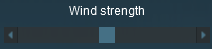
Move the slider to set the wind strength between zero (left) and maximum (right)
|
|
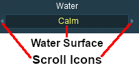
Set the Water Surface
|
This sets the water surface effects |
 |
|
|
Settings:
- Click the Water Surface to select from a drop down list of surface effects, or
- Scroll through the list by using the Scroll icons
|
|
|
Set the Snow Altitude
|
This sets the altitude at which objects with snow effects will display those effects. It has no effect on objects created without this feature |
|
|
Settings:
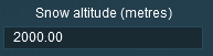
Enter the altitude, in metres, at which snow can appear. |
|
Trainz Wiki
 |
More Tutorials and Guides to Using Trainz
|


 Startup Option Rule and


 Setting the Lighting Conditions section above.


