Revision as of 12:42, 27 April 2024 by Pware(talk | contribs)(Created page with "<!-- V1.0 --> <table> <!-- BEGIN TOP TABLE --> <tr valign="top"> <td width=750> <table width=750> <!-- BEGIN TABBED link list with Home page active--> <tr valign="top"> <td...")
This is the original v1.0 Ucolta Map and description. For the latest SAR Peterborough Narrow Gauge Division v2.0 version click here. The v2.0 version of the route and sessions requires Trainz Plus or TRS22
Commodities:
Passengers
Goods
Livestock
Loco Services:
Water
Facilities:
Loop
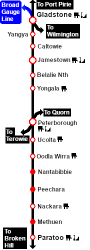
Distance from Peterborough: 13¼ kms, 8¼ miles
Unmanned station on the Port Pirie-Broken Hill Line .
Crossing, station and goods/stockyard loops with loco watering facilities.
After the conversion of the line to standard gauge (1969-70) Ucolta became just a crossing loop with a single goods siding. More recently, the loop and siding have been removed. The station is no longer in use.