SAR Oodla Wirra V2

From TrainzOnline
Revision as of 01:03, 28 April 2024 by Pware (talk | contribs) (Created page with "<!-- V2.0 --> <table> <!-- BEGIN TOP TABLE --> <tr valign="top"> <td width=750> <table width=750> <!-- BEGIN TABBED link list with Home page active--> <tr valign="top"> <td...")
(diff) ← Older revision | Latest revision (diff) | Newer revision → (diff)
Jump to navigationJump to search
    
PortPirie-BrokenHill
Ucolta
Location Index
Scenarios

Nantabibbie
PortPirie-BrokenHill
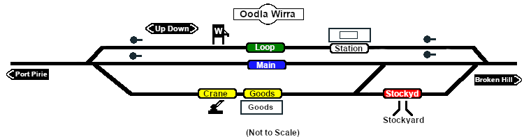
Oodla Wirra map
Links updated for SAR Peterborough Narrow Gauge Division v2.0. For the original V1.0 version click here

V2.0 requires Trainz Plus or TRS22 to run

 Commodities: 
Passengers
Passengers
Goods
Goods
Livestock
Livestock
   
 Loco Services: 
Water
Water

   
 Facilities: 
Loop
Loop
     

 Distance from Peterborough:  25 kms, 15½ miles
Unmanned station on the  Port Pirie-Broken Hill Line .

Station/crossing and goods/stockyard loops with loco watering facilities.

This location was bypassed when the line was converted to standard gauge (4ft8½in - 1435mm) during 1969-1970.

PortPirie-BrokenHill

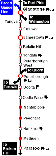
Gladstone-Paratoo Strip Map