|
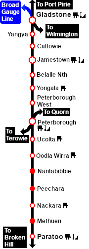
Distance from Gladstone: 43½ kms, 27 miles from Peterborough: 20½ kms, 12¾ miles
Unmanned station on the Port Pirie-Broken Hill Line . At 621m (2,037ft) Belalie North was the highest point in the entire SAR system.
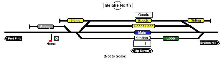
Station, goods and crossing loops with sidings.
This location was bypassed in favour of an alignment with easier grades when the line was converted to standard gauge (4ft8½in - 1435mm) during 1969-1970.
|