Updated for SAR Peterborough Narrow Gauge Division v2.0. For the original V1.0 version click here
Commodities:
Passengers
Goods
Grain
Loco Services:
Water
Facilities:
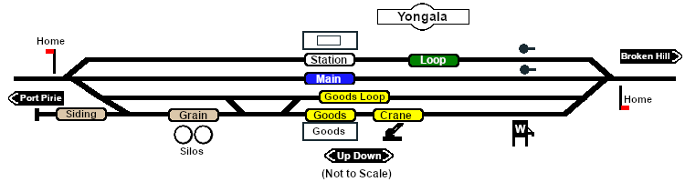
Loop
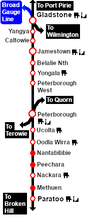
Distance from Gladstone: 55½ kms, 34½ miles from Peterborough: 10½ kms, 6½ miles
Manned station on the Port Pirie-Broken Hill Line .
Station and crossing loop, with goods/grain loops, a grain siding and a loco watering facility.
After the conversion of the line to standard gauge (4ft8½in - 1435mm) in 1969-70 Yongala became just a crossing loop and a grain terminal. There are no longer any passenger services.